
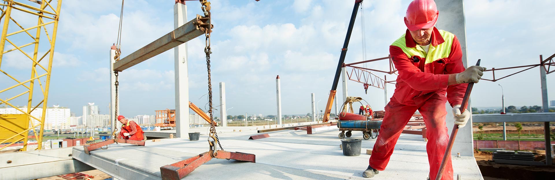
Next-Level Building: Drones, AI, and Reality Capture
How is reality capture technology changing the way we build? Join Greg Dunkle, STO Building Group’s Chief Operating Officer, Jon Ferguson, Vice President of Virtual Design and Construction at Layton Construction, Austin Lay, Senior VDC Manager at Layton Construction, and James Pipe, Chief Product Officer at Drone Deploy as they explore how tools like drones, 360 cameras, and AI are transforming project accuracy, documentation, and data management on today’s jobsites.
HOST
Greg Dunkle
Chief Operating OfficerSTO Building Group
View Bio
GUEST
Jon Ferguson
VP, Virtual Design & ConstructionLayton Construction
View Bio
GUEST
Austin Lay
Sr. VDC ManagerLayton Construction
View Bio
GUEST
James Pipe
Chief Product OfficerDroneDeploy
View Bio
Greg Dunkle 00:17
Hello and welcome to Building conversations, the STO Building Group podcast. I’m Greg Dunkle, Chief Operating Officer here at STO Building Group. So, joining me today are my friends Jon Ferguson, who’s the Vice President of Virtual Design and Construction and Business Development—he is with Layton. Austin Lay, our Senior Virtual Design and Construction Manager at Layton as well. And then our guest in the studio today, James Pipe, Chief Product Officer at Drone Deploy. So in this episode, we’re going to dive into the world of reality capture technology—growing leaps and bounds, the impact that it’s going to have on the construction industry. So let’s start by getting ourselves introduced to our audience and just share a little bit of our backgrounds. So if you would start, John, that’d be great.
Jon Ferguson 01:04
Yeah, yeah. So Jon Ferguson, like Greg said, I’m the Vice President of Virtual Design and Construction for Layton Construction, been in the industry just about 19 years, six of that being in the architectural design side, and then I flipped over, and I’ve been at Layton for 13 years now. So, really focused on everything, technology, VDC, BIM now, reality capture, just trying to focus and hone in on what we’re able to deliver to our clients and all of our projects.
Greg Dunkle 01:37
Yeah, I think Jon’s a little bit humble there. He has taken what has been fantastic at Layton Construction and really brought it across all the families at STOBG, so thank you there, and you’ve done some incredible work for us. Austin, help us get to know you a little better, too.
Austin Lay 01:54
Yeah. Thanks, Greg. Austin Lay, been with Layton Construction nine years as of yesterday. So, started at Layton, interestingly enough, in marketing, and that’s what my degree is in and I feel like I was a little bit, I don’t want to say duped, but what I signed up for, I thought was marketing, ended up being proposal development, which was not something I had a huge desire and passion for and at the time, I met Jon, and he was like, hey, I need help flying this drone because I’m so busy. Can you fly it? And I was like, yeah, sure, let’s do it like I’d never flown a drone before. And so yeah, we he took me up to a project up in Farmington, which is just north of Salt Lake, and we flew for the first time, and I kind of fell in love with it. And towards the end of that year, he said, hey, do you want to come join my team? And I said, sure. So I’ve been, since that point, I’ve been handling all drone operations through Layton. One of the first, I was the first person to be Part 107-certified. And now we fly across almost every project through the United States and then ever since we’ve been with STOBG, we’ve started to bring in some of those companies into the drone space. So it’s been great to see the program grow from him and I up in Farmington, Utah, to this big, giant beast that we have today.
Greg Dunkle 03:12
Yeah, and a good beast it is. I’m sure the drone and how you fly this safely, they have been used in a countless number of our project pursuits and even working with the operations team. So appreciate that, Austin. James, so your travels, bringing you to Salt Lake today, I’m out in New York City, so welcome and tell us a little more about yourself.
James Pipe 03:33
Yeah, well, thanks for having me. I’m James. I run product and design at Drone Deploy, and I’ve actually been at Drone Deploy now for eight and a half years. Still chasing close. Never going to make it. Doing my best. So, yeah, I run production design. That means that I spend a bunch of time with customers, working with them to figure out what’s the most valuable thing that we could build, and then going and actually executing and shipping it. So we try and do that on repeat every single month of every single quarter of every year, and, yeah, I’ve got to work on all kinds of awesome stuff that I didn’t know about before I started. I didn’t know about drones before I started at drone deploy. I didn’t know about mapping and surveying. Didn’t know about all the photogrammetry, interior reconstruction and all the AI stuff that’s coming online now, but it’s been an amazing ride, and so I’m looking forward to share some of that today. Thank you very much for your partnership. I think Layton has been a major marquee customer of ours for the majority of the time I’ve been at Drone Deploy and Drone Deploy itself, we’ve gone from 25 people in a loft that burned down in in the middle of San Francisco, to 270 people a global company office in the UK, and obviously all over the states, and then also in Australia, New Zealand as well.
Greg Dunkle 03:33
Great. Well, welcome aboard for today. So let’s start with a little bit of a soft ball. It’s kind of why we’re all here. We talk about reality capture and the technology that goes along with that. Jon, what is that? And what is it doing to transform our industry and construction?
Jon Ferguson 05:15
Yeah, so reality capture, really, when we’re looking at it in construction, is going out into the field and capturing data. We’re capturing data from the real world and then taking that to our teams and letting them digest that data. So whether that’s 360 photos, laser scanning, we’re able to take what is a current condition on the site, that exact time during that day, and duplicate that into a 3D model. So it intertwines with virtual design and construction and BIM and also flows right into the field. So marrying all those technologies together so that our project teams have an exact, precise piece of data and model that they can reference, measure, and utilize throughout their project. So really, I mean, it’s we’re enabling the field, if they’re not there on site, to be able to be as in tune to the project as they really can.
James Pipe 06:13
Yeah, at Drone Deploy, we talk about it being like giving everyone on the team superpowers. You know, you can travel back through time and look at exactly how the project was in the past. You can, you know, use X-ray vision, see through walls, etc., see where something’s buried, or see the end wall after, you know, later on in the project, it really helps save time basically on site, for sure.
Greg Dunkle 06:38
It’s like having a couple extra superintendents on site all the time. That’s great. So moving on to Austin, I want to have you have the opportunity to talk to us about some of the tools with reality capture, such as LiDAR, photogrammetry and 360-degree cameras, and how that’s, you know, what’s in your toolbox as you go around as our pilot?
Austin Lay 07:01
Yeah, definitely. So I talked a lot about drones in the beginning, and that’s kind of where this all came from, right? Jon asked me to take care of the drones, and I took care of them, so we started flying them. And I think that the suite of tools has really kind of grown based off of drones, at least for us at Layton, right? Like once people understood, okay, we have this machine that can fly through the air, it can take pictures, can take photos. What more can it do for us? And I think that’s really if you look at technology as a whole, and in reality capture. I think that’s the question that gets asked the most is, once we’ve used this piece of equipment, how do we advance it? How do we get it better? So then we started with a company called StructionSite, 360 camera capture, right? That’s taking a 360 camera on a selfie stick or a hard hat mount, walking around the project and capturing it kind of from the ground view, right?
Austin Lay 07:45
Later down the road structure site was acquired by Drone Deploy, which is now Drone Deploy Ground. So that made a real seamless and easy transition from our teams to that because we’re able to live inside that ecosystem. And then on top of that, you know, I also help and oversee the 3D capture from a laser scanning point of view. And so that is a tripod mounted laser scanner. That, we, you know, prefer Leica, there’s Faro, there’s all kinds of different companies that make them, but we will, you know, you strategically move through a building with this laser scanner capturing those images, and then you create a digital twin, basically, of that space. And so when we see a lot of that is when we’re going into existing buildings, right? Is, hey, we have this building that we’re going to demo, but we don’t know the drawings are. I mean, what some of these drawings like? What 1920? Yeah, so it’s like, we need to know what this looks like. And I don’t know. I mean, I’ve been in the field where people are literally, like, with a tape measure and a pencil making notes, and I’m like, that feels and seems exhausting when we can cut that in half and then do it in house.
Austin Lay 08:51
And so the laser scanning has been a big thing that we’ve been pushing, and it’s been a big success for that. And so when you look at all those tools, right, that’s kind of our toolbox. And then from that we have some, like, stationary cameras that we use. Cameras that we use. The nice thing about those is they also integrate into drone deploy. And so we have this one living ecosystem that has our drone photography, or 360 camera and then our site cameras. And so it just makes it really nice for that superintendent or that project manager who needs to show something to an owner where it’s like, hey, everything lives in this one single link. There’s no need to, like, have eight different browsers open and so, and I would assume, James, you’d feel the same way. That’s why you guys brought it all together. One ecosystem. So it makes us as customers happy that we only go to one place and collect it all.
James Pipe 09:38
I mean, so our software is basically used for answering questions, right? And so if you have to go to five different people to get your question answered, that’s really frustrating. If you just go to one place, ask the question, find the answer, move on with your job. That’s really what we want to create, and that’s why we’re going to keep bringing more reality capture into that one window.
Austin Lay 09:59
Yeah, and one thing I didn’t even touch on, right? There’s all these different kinds of exports that we have, you know, to Autodesk and different things, so we can even push that information out to the softwares that we’re already using.
Greg Dunkle 10:09
So, you know, you briefly touched on how important it is when you’re going into a structure that may not have the as-builts, or certainly is old, and as-builts could have changed time. You know, as different contractors came in, what challenges Austin, do you see that this has solved for you, specifically with being able and whether it’s the, you know, the laser, or it’s even the drone? Can you give us a, like, an exact example of, hey, this is where it really got us, either accelerated in the precon, or was very useful to make sure that in our development of coordinated drawings, we were in great shape.
Austin Lay 10:51
Yeah, no, definitely. There was a project specifically, it was a healthcare project in a hospital. And we had gone into– this hospital had been around for many, many years—and there was, as most of these hospitals go right, they always seem to leave empty space as needed, and which is fine, but then, like overtime, like you said, Greg, different contractors get in there, different people get in there, and sometimes things just get missed. And so we went into this hospital it’s about 15,000sf of a room, and they just had all this duct work that was seemed unnecessary. And even the trade partners had come in and looked at it and said, “I really think we could move some of this. I don’t think that some of this is necessary. It feels like it’s overkill.” And so the project executive said, look, let’s just laser scan this whole room. Let’s just figure out how it sits, how it works. So we end up laser scanning this entire room. We then take that laser scan into Revit; we model that based off of the dimensions that are in there. And then we turn that over to our BIM team, and our BIM team then takes that, and they work with the different trades, so the mechanical, the electrical and the plumbing, and they start dropping these models in on top of that model. And then it’s clear as day. At that point, you can see exactly where these ducks are going to hit something. You can see exactly where these problems are going to happen. And once, that was kind of our initial use case of why laser scanning is important, and from there, it’s just really grown into, like, what it is today, because now teams are like, so you’re telling me that I can have this done before we even start construction, and then I can know for sure what the problems are before I start building? And I think Jon could probably speak a little bit to this too, but it’s like, I mean, how much of a headache is that for people to deal with right in your as you’ve dealt with people through the years? It’s like, if you could have coordinated this or understood ahead of time, right when you think that’s such a –
Jon Ferguson 12:33
Reality capture in general has it’s somewhat evolved from a reactionary solution to problems, to where our first request we were always getting was, hey, we just ran into a problem, how can we solve it? And now we’re pushing to say, if you’re continually capturing, like you said, they walked into the space they didn’t really know what to do with it, that’s a reactionary scan. We’re now pushing teams in from small TIs, small renovations into large scale healthcare, mission critical. They’re scanning up front so that they’re capturing it before it even becomes an issue. So it’s shifting a little bit from that reactionary into more of what you’d see with BIM coordination VDC, where it’s we’re pre-planning, we’re providing that predictable outcome, and reality capture slides right into that. It’s not so much reactionary anymore.
Greg Dunkle 13:26
Maybe you can comment on just the accuracy Austin and Jon, like to what scale when you’re laser scanning, are you able to bring to the team? So that’s you’re really taking out anything that’s unknown.
Austin Lay 13:40
Yeah, so laser scanning is all subjective to distance from where the scanner sits to where the object sits, right? So if we look at it on a football field, that might be the best way to visualize it, and you set that scanner in the end zone, on the zero-yard line, right or at the goal line, sorry, and you’re trying to capture the distance at the 50-yard line. Well, incrementally, as you move away from the goal line. The closer the scan is to that object, the higher that’s going to be. So you’re talking 16th of an inch, sometimes even 30 seconds of an inch. If you’re really close, when you get to that 50-yard line, you could be at an inch drift at that point. And so that’s why it’s important when you laser scan. And this is, and I can have James talk more about this on the drone side of stuff, but it’s like you build, it’s like you’re building a puzzle. And in the drone world, we call them GCPs, right? Where we kind of map, pin down this map. When you’re laser scanning, it’s the same way, right? Like, think of it like a map. You got to be strategic of how you move about that project site, because if there’s not enough overlap, or if you don’t have that scanner close enough to some stuff, then all sudden, your accuracy drift becomes pretty large. But I think if James talks a little bit about how the drone accuracy works, because we’ll marry the two, if the site is large enough, we’ll do, you know, a laser scan on the inside and with the drone on the outside, and then take both those things and marry them together.
James Pipe 14:55
Yeah, absolutely. I mean, so you can see on this drone in the middle here, it’s got a little top hat on that effectively allows the drone to know exactly where it is to within a couple of centimeters globally. And by knowing exactly where it is, we know where the lever arm to the actual sensor inside of the camera is. And when you know where the sensor is, you know where the light’s hitting, you know the lens, basically you can calibrate the lens, but these kinds of drones do come with a calibrated lens from the factory. You can figure out very, very accurately where points in 3D space are, especially when you get a lot of images. So every single image that’s captured, we were looking at one of your projects earlier, 1,700 images, every single one of those, you know exactly where it was taken, to within a couple of centimeters. And then you are using computer vision, you’re figuring out how all those photos fit together, and generating 3D depth from that.
James Pipe 15:53
And actually, what we found is even compared to aerial LiDAR systems, unless you go up to the $180,000 aerial LIDAR system, you can actually get higher accuracy data from the photogrammetry point cloud than you can even from LiDAR at range, but to your exact point. If you care about—often people care about different scales of stuff, right? You care about the whole project because you’re doing coordination, you’re doing logistics. You care about one particular building, because you care about the location of concrete sleeves, for example, and then you might care about cracks in the concrete. And you just need a different scale of reproduction. You need different tools for those different kinds of jobs.
Greg Dunkle 16:32
Just for our friends here in the States, so a centimeter, let’s just make it really less. We’re going to bring it back to the US soil for a minute for all of us folks. No, no, that’s all good. That’s great stuff. It’s why we’re all together, right? So, Austin, real quick. Obviously, when you’re setting up, whether it’s a drone or whether it’s a stationary laser scanning, you are going to be collecting just volumes and volumes and volumes of information and data. Maybe you can talk to us a little bit about how, when that all comes in, how is it stored? What are you doing with it? How do you integrate that back into the model? Just maybe get a little—I’m a bit of a nerd myself—maybe you can nerd out for us a little bit on what we do with all this data?
Austin Lay 17:26
Yeah, no, definitely. I’d love to. It’s interesting, right? Because I think that, I think Jon and James would both agree that’s the biggest bottleneck in this, you know, we’ll get a project in the middle of nowhere America. I can’t think of the name off the top of my head. But, you know, and they’re mapping something from the drone side that’s going to take two thousand photos, but they only are running off of like a Wi-Fi hotspot, right? So it’s like, how are you going to upload all this data without having some sort of secure internet so I’ll talk a little bit about the drone side. So, and that’s in that sense, right? Good internet connection is really what’s going to drive that. Because that’s the biggest reason we’ve partnered with drone, one of the biggest reasons we’ve partnered with Drone Deploy, because they host their stuff on their cloud. And James can talk a little bit more about that, but it’s a simple upload. Goes to their – you go to bed, it’s like magic, you wake up and it’s there.
Jon Ferguson 18:12
We’ve seen some pretty interesting ways to upload that when you have no internet on site.
James Pipe 18:20
I was going to say, when are you guys getting your Starlink contract?
Austin Lay 18:23
No, no, we have Starlink. That’s definitely changed the game. But to answer Greg’s question, a little bit more depth, when it comes to a laser scan, that’s where it really becomes a problem, because you’re doing a laser scan that has two to three, not 2-, 300, let’s say 150 scans, that data set becomes 60 to 75 gigs, and then it isn’t really hard to share with people. And so what you need is good backing from your IT team, or from Jon, who’s allowed us to buy these, get us these nice super computers, basically, that can run all this power. And then at that point, once it’s processed, you can take it into like a recap pro or something, and decimate it a little bit to where the file is a lot more workable and manageable. But I would say that’s probably one of the biggest hindrances in laser scanning, and I think that’s a big reason why a lot of people may be afraid to pull the trigger on doing it in house, because it does take a lot of bandwidth to take that on. And I think it’s easier to just say, we’ll pay someone to do it, let them handle that, just give us the stuff at the end.
Jon Ferguson 19:21
What we’ve done, kind of in-house to alleviate that stress, is what we call scan to BIM. So we’ll take the scans, these huge data sets, you know, we’re talking terabytes of data, and converting that into a Revit model. So we’re taking the piping so that you’re not referencing the point cloud anymore. Now you have an accurate Revit model that you can use, you can digest, you can throw it up into the cloud, into any of the coordination software, and actually use the model. That’s a huge step. And a lot of the interior work is going in scanning these 10, 15,000sf areas that are existing, getting the structural components all the MEP above the ceiling, and then converting that into Revit so that the design team can use it. The trade partners are modeling their systems off of what’s existing and ultimately using that in coordination. So I mean, it’s we’re capturing it and then converting it into a usable space. Because if you just hand somebody a point cloud, say, a superintendent, their laptop doesn’t even open it, to be honest.
Greg Dunkle 20:29
So, what maybe, and let me pick at this just a little bit more, once you get done your onsite scanning, what does that time period look like for you all to convert it into a usable product for operations?
Austin Lay 20:41
Yeah, I’d say it really depends on the size, right? So let’s just, for base, we’ll say 10,000sf, because that seems to be a solid number that we scan a lot of, usually on site for two to two and a half hours at the most. So that’s one thing that I think shocks a lot of people, when I come on site, they’re like, okay, we’ve got the site cleared for the whole day for you. Like, all right, well, only going to be here for a little bit, but I appreciate that so and then, and then we do, we do the scan, and then, I mean, same I’ll process it the same day, so that that gets you to, like, point B, that gets you to a usable point cloud, and then from there, depending on what the MEP, what the different structures they want modeled, that will that’s kind of where the lead time comes in. Now you’re talking a couple weeks for our modelers to model all the little nuances of it. You know, I can’t tell you, though, how many times I’ve scanned a hospital and there’s like, 100 hospital beds, and then people, it’s funny, and I think anybody who’s done technology and construction can say this, if I bring that scanner out, I’m going to have about eight to 10 people walk up and stick their head in it, look at it, take put their phone up, try to take a picture of it.
Austin Lay 21:45
And it’s like, what are you guys doing? Like, I’m trying to like and I could tell you stories for days about when we first took a drone on site, when we first took a robot dog on site. And so my point is, like, it’s really a quick turnaround now, again, it’s all dependent on size, right? So 100,000sf facility we’ve scanned, that took about two days to process, and then another the modeling really doesn’t take much more time, so you’re still at a two-to-three-week lead time for a model. So I’d say even our largest facilities, we’re talking less than a month time to turn it all around,
Jon Ferguson 22:16
And we have during our BIM coordination, like our kickoff meetings, in our BIM execution plans, we outline the level of detail, especially so we know ahead of time. Say, if it’s under half inch pipe, you know, do you care about it? Do you not? Do you include this? Do you not? So there’s a lot of different scoping and to make sure that we know and we’re not wasting time modeling things that don’t really affect the coordination. So being really strategic before Austin’s even out there, so that the project team knows exactly what they want to scan, exactly what room they want to go into, and then we know which rooms are getting coordinated is super, super important, because it does take time and people expect, especially nowadays. Hey, you were here out scanning. I want this tomorrow. There’s a lot of level setting and expectation to manage there.
James Pipe 23:11
You made me laugh when you were talking about the size of the data, because we’ve got an offline deliverable for the ground piece, right? People love it. We have to have a warning on there, because people, you know, everyone’s throwing data in. And when they, when they read the data, they’re not reading all the data, right? They really look at one photo in one room at a time. And it means that this, you know, massive data set to them is just instant. It appears in the browser, like Facebook it’s fine, but then you say, offline deliverable, and we have to put in Are you sure? Because we’re creating files, and multiple terabytes of data, if your computer is dead, you’re not going to open it. You’re not going unzip it. If you do, you now can’t use your computer anymore. It’s like twenty iPhones of data stacked up. So yeah, it’s interesting, especially the web tools are pretty cool because they let you only stream that part of the project, right? If you zoom in on the corner of the project, you’re only getting high detail in that corner. And one of the things we need to do better at is allow you to just export that little corner so that you can digest a review on your desktop. Because I know, you know, a lot of people want to do that. You don’t want to decimate the whole project down. You want the highest resolution in that corner. But yeah, no, it’s a big problem, big data.
Greg Dunkle 24:33
Jon, you hit a point talking about the strategic use and strategic timing. I think there’s also a lot of communication that your team needs to do with the folks on site to make sure you capture it at the right time. Certainly, going in and doing it. A pre demo may help you, in some instances, with just a you know, what was there? What did it look like? But also along the way, after select demo, or even harder demo, may, you know, provide more information. Question for you to move forward. So when you take this data and you capture it, certainly, you know, helping the team with either project planning, looking at progress tracking and decision making, I’m familiar with some of the tools like Buildots, who also does reality capture and then really ties that to your p6 and your scheduling software. What have you seen as a specific example of either the project planning or some progress tracking? Maybe Buildots? Maybe another part of your experience that has really paid off, in your opinion, that you can give us a little bit of where that goes right at the beginning of the job.
Jon Ferguson 25:41
Yeah. So, I mean, there’s, we have been testing a lot of the different softwares, Buildots being one of them. This seems to be one of the kind of next iterations of reality capture. At first, it was just capturing photos looking at that static point. And you know, the James’ of the world. They’re like, okay, now what’s next? Can we start doing predictive analysis using machine learning? AI and really these tools are taking this 360 photo, they’re taking the project schedule, they’re taking the BIM coordinated model. They’re taking all of this information and then using machine learning to predict and see what project is or progress has happened on site. So it’s giving you a very detailed percentage of work complete.
Jon Ferguson 26:30
And so we have a major client, the building healthcare all across the country, and they were so much value that they were actually having this contract, this license of software, was on their end, because they saw so much value in it, they required their contractors to utilize this software. And that’s really where we kind of dipped our toes in the waters of progress tracking. And they use it on every OAC meeting, Monday morning meetings, they’re pulling up the dashboard the statistics of what percent complete is HVAC in Zone One, and really using that to double check and verify work in place, so that not only are we keeping up with the schedule, but we’re catching any potential items that might be falling behind, down to the very specific trades. So you know, electrical duct work, anything above the ceiling you can track, predict, and have those conversations before it becomes an issue.
Greg Dunkle 27:34
You’re hitting on something really important too, is with reality capture. It’s more than just the memory of a superintendent or a scheduler walking through you’re going to get real time information. I think one of the things that stood out with Buildots is they actually with this kind of reality capture, put a life cycle of when was something actually worked on, and were there periods between that being worked on that may go to do you have some other issues on site that you need to address? So bringing that with what the advances in the reality capture, maybe I can ask James, what’s what do you see coming? What? Where’s your where’s your platform going? What do you see that’s really exciting for either how we’re capturing it, what we’re doing with it, give us a little bit of look into what the vision is with your group there.
James Pipe 28:23
So it’s all layers, right? So we build up from knowing exactly where the photo is super important, because then you can compare it to the model, right? So start with photogrammetry, build on top of that, add high accuracy, build on top of that, and you start to get to the AI space, and we’ve seen this. There’s been multiple waves of AI that we’ve utilized at Drone Deploy. And this new wave is particularly exciting and a massive deal. The reason it’s a massive deal is because things you used to need hundreds or thousands of images to train a machine learning model to understand now is actually baked into the models from the start. They’ve seen every photo that’s on the internet. They’ve seen they’ve read every word that’s ever been published. The biggest weakness of these, you know, foundation models, is they haven’t they haven’t been reading proprietary data, so they haven’t been reading contracts necessarily, and they haven’t been seeing inside of a building.
James Pipe 29:27
So what we’re able to do is then add those two layers on top, so we’re able to add these construction focused images and really get to the next level. And what is the next level? It’s what you’re describing there. It’s you just capture the data. You do exactly what you were doing before, but we start to be able to deliver you insights every single day. We start to be able to give you percent complete on the interior and on the exterior. We start to be able to highlight safety risks. You know, we’ve been working with you on our safety AI product, and again, it’s you shouldn’t need to do any more work. Basically, you’ve got this AI, this little robot in the computer that’s doing the work for you.
James Pipe 30:06
It’s trying to be the assistant to the folks on your team. It’s your, you know, an assistant to your superintendent that has perfect memory. So you can just ask it a question, and it will show you a picture of that room on that day, or the comparison of how much work has been done over the last week. And for your safety team, it’s an assistant. It’s walking the site every time your intern with a camera walks the site, right? And in the future, obviously these, these things, will be more and more robotic captured as well. So for us, you know, we’re trying to unify all of this data into one place so that we can answer your question directly. We’re trying to automate the capture of it. You guys already use multiple docs. You got six up and running now. And there will also be robots on the ground. We’re seeing this amazing machine learning driven movement on the ground, which means that, you know, these little robots start moving around like cats, and it starts to get pretty scary. But so that’s going to happen on the ground. And then, yeah, you’ve got docs, and then the third pillar is, is AI intelligence, so just capture will bring you insights, and then you can actually interrogate those insights, that data for, for additional answers to your questions.
Austin Lay 31:20
I just want to touch on that, too. And to Greg’s point, about Buildots, right? I think in Layton what we’re seeing, and I really see this across the whole industry as a whole too, not just at Layton, but there’s different. I feel like some of these progress tracking, it’s, it’s kind of like, where’s the price point at, right? And how much do I have? Because we want, we would love every project to use some sort of progress tracking tool. The problem is that it can be very expensive, right? And so strategically, you got to pick those projects that you can take it on. But I can tell you right now, everybody I talk to wants some sort of progress tracking functionality, right? It’s not a matter of how do I get this? It’s a matter of, unfortunately, budget, sometimes, like, how do I pay for this? And so I think the key to what’s made reality capture for us strong is, you know, I try to get in with the estimators and those people early on and say, put this in your budget, because at the end of the day, if you don’t use it, I’m sure you can, okay. I mean, I’m not an estimator or a project manager, so I can’t, I don’t know exactly how the money side of that works, but what I can tell you is, it’s a lot easier to put that in your budget, and then for me to come and say it’s going to cost this much cost this much, and then them say, oh yeah, we have some money. And instead of them saying, oh crap, we got to try to find money for this.
Greg Dunkle 32:29
You make a great point. When you’re planning for something like this, and you’re going to use reality capture, the value of the human superintendent being engaged with other individuals on the job to solve real problems is a better use of time than the walking off the job and the old let’s go ahead and we’re going to make our checklists, and we’re going to whether it’s safety or its schedule or it’s what was put in place, and documenting that, you basically can free up almost an entire superintendent on a project, if you plan for this, and you’re going to get, you’re going to get better results from it. And then, I’m certainly a believer in that. What would be an optimum, I’m going to go off script here a little bit. If you were to say, boy, if you could do this. Well, we have drones and dogs and cats, as James says. We got all sorts of animals running around there that are bionic, for lack of a better word, what would be like the coolest space age, we’re doing it every day. Everyone goes home at night, the site’s empty, and we’re flying through, is that the holy grail of reality capture, every day?
Austin Lay 33:46
I think we’re somewhat close to that, honestly. And I think that’s the reason why we’ve partnered with Drone Deploy, because James touched on this earlier, but I’ll hit on a little more. We have doc drones flying on projects right now, which I think, 2017, 2018 we went to a conference and saw something that was 2019, yeah. And it was like, being talked about, and it’s like, oh, that’d be cool. And the demonstration didn’t even work. So I was like, okay, well, I get his technology and so yeah. But now, you know, with the advancements of drones, with the advancements of waivers that we’ve secured through the FAA, to your point, Greg, we’re able to just literally leave the job site at the end of the day, and all these things autonomously will fly through the air.
Austin Lay 33:46
Robots will, you know, crawl, or walk across the ground with a LiDAR and a 360 camera on it. So, I would say we’re here now. Obviously, there’s going to be plenty more advances as we go. But you know, the optimal job site is where a project manager, a project engineer and a superintendent can focus on the things that they have to focus on, and not so much the technology side of it a big, a big point when I go to a project is I always tell them like, I’m not here to disrupt, I’m here to just like fit in. Because I think a lot of times people will see technology and they’ll be like. And I’m not trying to, you know, segregate anyone, it’s age group. But you’ll get some of these older superintendents who are like, I don’t want to deal with an iPad. I don’t even want to deal with anything. Like, just, just have it, do it for me, and I get it. They have a certain workflow, and they and they do a really good job, but it’s like, and that’s why I try to tell them, like, look, I’m not here to make your job harder or more, you know, complicated. This is really going to help you. So the training side of that, too, becomes an issue as you’re trying to have these people understand and learn. But I mean, I would say we’re most of the part there.
Jon Ferguson 35:29
Quickly, to add to that is this kind of hits all construction tech. It’s not just reality capture. We had to do the same thing with BIM coordination. When it first came out. It came out. It was this new innovation. Now it’s standard practice on all of our jobs. And if you look at construction as a whole, and I’ve had to do this is and go back and see, you know, why was there so much hesitation? It goes clear back into like, the industrial age of, you know, they just barely started to figure out how to do mass steel plants. And you know, that was what we’re dealing with two hundred years ago. And then you fast forward again, and they have the introduction of, like, prefabrication was really, really big 10, 15 years ago. Now that’s somewhat standard practice. You fast forward BIM and technology like this, project management has only been around for about 10-ish years, and so we’re right into this stage where we’re past, kind of the proof of concept, at least for you know, Layton in some of the groups, we’re past the proof of concept, they now trust technology.
Jon Ferguson 36:39
So you get some of the older, more seasoned people in their career. They’ve never even seen a lot of this technology. They know they remember before this even existed. So we’re now implementing technology that’s totally brand new. And so one of our biggest hurdles is just educating and sharing, you know, what we’re doing and reality capture, like Austin said, you show up with a drone, and everybody’s like, whoa. This is awesome. My kid has one. I got my son that from Best Buy. Oh, I know how to do that. You know it’s; it is a shock factor and a wow. But we’re really fine tuning the value of reality capture to where it’s, I’d like to say we’re at the point where it’s not so much of an innovation. Now it’s, if you’re not doing it, you’re really kind of behind. And this has all happened in a span of 10 years. You know, we were pretty stagnant and as an industry for hundreds of years, doing it the exact same way. And now everybody’s shifting super-fast.
James Pipe 37:41
What we say at Drone Deploy, which is definitely stolen, is the future is here. It’s just not evenly distributed. And so we, you know, we quite literally have data center projects where we will have a dock drone capturing multiple times a day, every single day, multiple times a day, completely on a schedule, does it autonomously. Data gets uploaded, processed 3D model comparable over time, comparable to BIM. We have robot dogs walking around oil and gas fields, scanning, doing thermal scanning, acoustic scanning on systems every hour of the day, and it’s just not everywhere yet right? Like people are figuring it out. They’re doing the ROI analysis. The robots are coming down in price. You know, the docs that you’ve got five years ago, they were ten times as expensive.
James Pipe 38:35
Yeah, it was insane. But the same thing that’s happening in the area is going to happen on the ground as well. And the these little terrifying robot cats will actually be, you know, $10,000, and it’s going to be amazing. So yeah, for us, it’s, you know, that imagined future where, yeah, the robots walk around. The 3D reconstruction happens, you compare it to BIM every day, we’re testing our own progress; AI product right now, Greg, and that runs in 90 seconds once the photogrammetry is done. So like this stuff is crazy, but it’s only just happening. The product the way that we’ve built our progress product was not possible. There was no technology in the world to do it a year ago, literally, a year ago. So, yes, other people have been able to build these things, but they’ve had, you know, lots of people clicking on stuff in in distant places in the world. You know, it’s like an outsourced VDC team. That’s awesome. But now the actual AI technology is there. You can do it in a completely different way, and that’s why we’re super excited about this, this wave.
Greg Dunkle 39:48
Yes, it’s interesting to think about what’s coming to the market now. And you said, you know, certainly we’ve had BIM and there’s been some laser scanning, and now with the single source of truth, with this, all this data that can be collected. Like you said, once or twice a day. Imagine the construction site where you don’t have conflict between trades and GC or GC and owner, because it’s a let’s, you know, let’s throw the red flag and let’s get an instant repeat. And, you know, you get to see the replay on the big screen. And all of a sudden, while I was there. I wasn’t there. I did this on that date. I didn’t that’s gone all of the all that controversy that used to be, you know, part of a construction project, if you do deploy, you know, something like this, with the reality captures, you know exactly what happened, when it happened, and by whom, and whether you’re talking about safety or progress or quality, it absolutely changes the game where now it’s more about, how do we move forward, then how did we get here?
Greg Dunkle 40:47
Because how we got here is, is an instant replay. So certainly, certainly great there. What do you guys think of—you touched a little bit on how some of the maybe the leadership and management forces are either a little bit skeptical, or we need to move past that. What about owners? And have you seen anything from the authorities having jurisdiction engaged in wanting to review and look at things? Where does this take us now that it gets past our operations teams being able to deploy it and use it? How far does it go?
Austin Lay 41:25
Yeah, I’ll take this first crack at this, because it’s interesting, because I would say, three years ago it ended there, right? It ended at the superintendent and the project manager. And just more recently, I’ve started to talk more with, you know, not so much, like owners, but like, the project teams would be like, hey, can you present this to our owners rep, for example, he wants to understand what’s going on. So I had this presentation just on Friday where we sat down with the owners reps. We went through the whole Drone Deploy system, we went through the cameras, we went through all these different things. And it was just it was so odd, because normally I’m trying to sell this to a project team to use, and now I’m talking to this owners rep, and he’s like, why have we not been using this? It’s like, you know what?
Austin Lay 42:04
Maybe I should just only talk to owners reps going forward, because these guys were, yeah, they were so jazzed. He’s like, this is we’re doing this. No questions asked. So it’s like, and that’s usually my pushback. It’s like, well, we don’t have in the budget, okay, but then our owners rep doesn’t want to pay for it, so now we’re in a really bad bind. I’m not saying it’s always going to be that nice, but I’m telling you, the confidence from that meeting was high, because to see their excitement around it was really cool. And that was just a few pieces of the puzzle that were showing them. And so I would say that it’s becoming more now. I’ve been more engaged in those conversations Greg than I ever have been before.
Austin Lay 42:38
So for me, it feels like, you know, and Jon can speak differently, because he’s engaged in those a lot more than I am. But for me, it’s a situation where, you know, the project teams are now sold. They understand it, they just don’t know how to speak to it all the time. And so that’s where we come in and help them try to navigate how we speak to it. I think a lot of times these guys, I’ll see him talking about it when I’m on site and it’s like, there’s word vomiting. I’m like, whoa, whoa, whoa, hold on. Like, just the other day I was in Phoenix, and this kid’s like, yeah, we have this drone. It’s got LiDAR on it. I’m like, no, does not have LiDAR on it. Like, be careful what you’re saying to people. He goes, well, it has LiDAR I was able to measure. I’m like, no, I get what you’re saying, but that’s not and he’s like, well, there’s a point cloud in there. I’m like, again, I get what you’re saying, but there’s no LiDAR on this drone. Like, so my point is, like, sometimes it’s just like, people do get jazzed about it, but it’s like, pump the breaks. We got to educate a little bit. So, yeah.
James Pipe 43:27
I mean, the challenge for you guys, you’re paying for this technology out of your margin, whereas, you know, these owner operators, this is the incredibly valuable asset that they’re going to amortize for, you know, one hundred years, and they want to know exactly how it was built. And, yeah, that’s what we’re starting to see now, is folks who are building data centers, fabs, owners of massive oil and gas facilities, for example, they care about the facility, right? They want to know that the work is really good and they are willing to pay large amounts of the total cost, because, yeah, it’s super important that it gets built on time, especially with a data center, right? You ship it a month later, you probably cost, well, at least $10 million worth of processing that they could have done in that data center.
Jon Ferguson 44:18
We’re seeing a big shift in just the proposals we get as well the ownership our clients know that this technology exists, so now I’m getting pulled in a lot more. There’s a specific call out that says we require an as-built model or digital twins or facilities management. They’re now, like I said earlier, the wave of reality capture and BIM isn’t so much innovative, where we’re selling it as a differentiator. Now we are selling, this is how we do it, and these are our processes and how it’s better. But the owners are acquiring it in their in their contracts. They’re requiring an as-built delivery, which then kicks into gear. Okay, well now we have to do BIM coordination, and throughout construction, we have to document, make, do reality capture, then we have to adjust the model to fit what we coordinated in the field. And so there’s a lot of things that owners are now requiring that is pushing that early decision clear in pre con, where you have to have budget for BIM reality capture in order for us to meet this as-built deliverable. So we’re getting pushed from owners now to deliver this, and so we kind of have to have an answer for it.
Greg Dunkle 45:38
Yeah, I think one other point of there too is this is our subcontracting network. Certainly have to embrace it, because if you’ve been part of a project, and you know, the trials and tribulations of getting close to the end of the job, something gets covered up. You have, you know, destructive testing in order to get that either verification that the work was put in place. But even, like you said, you know, there was a huge amount of time that used to be spent by our subcontractors, redlining drawings, submitting the drawings as red lines, putting them all into one package for, you know, a final as built. So I think, not only from our perspective, but the owner perspective, the ability to not to have the demoralizing, hey, rip all that drywall out. We need to make sure we know what’s in the wall. There’s a lot of benefits to our trade contractors out there that if they get on board and say, hey, we’d like to contribute as well, another avenue that everybody benefits if we do this. And certainly the work’s got to go in properly, but it would definitely help this. You don’t have to work back out in order to prove what you did was correct.
James Pipe 46:41
On that side of things and on the also on the payout side of things, there’s definitely a future, and it’s very close, where every payout automatically gathers the data required to prove whether it should be paid or not, just as soon as it gets created right. Just pulls context from reality capture. And here’s the evidence, yes, you should pay this. And you know, these are all the rooms that were where work was done, and this is the work, and there’s no deviation.
Greg Dunkle 47:08
You may have a sub that’s been under billing traditionally that says, wow, look what it’s done for me. And it also protects an owner and a GC where you’re not overpaying for work that wasn’t yet complete and then have that issue of something catastrophic happens. So certainly those two things are great, if you all were to take a look, and we touched a little bit on robots. And certainly we had those that walk, we have those that fly, we have those, I guess, that we wear on our hard hats. What’s next with reality capture in the robotic world will be a hybrid that flies, walks, crawls, digs, swims, goes in pipes. I mean, where else can this go? I mean, you see the some Sci-Fi and think about, you know, very small drones that you know can just go about anywhere and do about anything, is, what do you guys see coming up there?
Austin Lay 48:04
Yeah, well, it’s interesting, right? Because as I was preparing for this, this podcast, I was thinking, so back in 2012 I was working for a company doing, oddly enough, metal recycling, but one part of that was tech recycling. So you can’t just take your laptops and stuff to the landfill and dump them, right? There was, we had to take it to this place. And I remember talking to the CEO of this tech recycling company, and I said, “Where do you see technology going in the next five years?” And he goes, look, I guarantee in the next five years we’ll be wearing technology. This was pre–Apple Watch, which is crazy, right? I had, at the time, I had this, like Nike fit thing that it was like a band you’d wear, and it would tell you, if you, like, counted your steps, right?
Austin Lay 48:45
And so the reason I say that is because that was in 2012 and I thought in five years, we’re all going to be wearing tech? That seems silly. Well, now look at it. I got an Apple Watch on. I have my smart glasses on, I know, we have drones. I mean, every bit of our lives is consumed by some sort of technology. And so I think that, you know, you talk about how some of these robots were at the time when we first looked at them, like $100,000 and then the other day, it’s like, we can pay for one credit card. Now it’s like a couple grand and they and then that same company also has some human noise, which is a little eerie to watch them run around. But no, I think, I don’t think we’re far off from a place that does all those things that Greg just said. I mean, we’ve already seen people put GoPro’s on RC cars and run them down tunnels, and I’ve seen all kinds of different stuff like that. So I don’t think it’s, I mean, I’d be curious what you two think, but I don’t think it’s that far off from having something like that.
James Pipe 49:03
Oh, yeah. From my perspective, everything’s getting much easier, right? The high accuracy is getting easier. The drones are getting smaller. The cameras are amazing. It’s just like one of the things that we set about trying to do for the last two years is high accuracy by default. You don’t have to know what you’re doing. You just turn it on, you press fly, the drone flies, and it’s all high accuracy.
James Pipe 49:58
The docs make it high accuracy by default, because you survey the doc in which is awesome. The thing I’m quite excited about, you have those glasses on. Everyone is going to have a personal assistant, and that personal assistant will have a perfect memory and will have access to all the drawings, all the documents, all the contracts, is going to be available all the time, and we’ll be able to see what you can see and when you get and therefore know where you are on the project. So you walk into a room ask a question, it knows which room you’re in. It knows the history of every single thing that’s ever happened in that room. It knows all the contract side of things. It knows there’s open RFIs, and it can answer your question extremely accurately. Maybe you didn’t even need to walk into the room for that reason.
Greg Dunkle 50:41
James, let me jump on that one. So I have a client who’s using augmented reality of those classes, just as you say. And what we’re all we’re all faced with in this industry is a shortage of the journeyman, the 30/40, year, you know, salty dogs that have seen it, done it, whether you’re a pipe fitter or whatever. And what they’re doing is they’re utilizing close to or having retired persons who are on the other side of those goggles, you know, that are sitting in Boca Raton or somewhere where they’re retired, logging in.
Greg Dunkle 51:14
And they may have seven, eight, ten, you know, apprentice or young journeymen that don’t necessarily need an expert at every point of the day, but when they do, when they’re in a cabinet, when they’re in some high tech piece of, you know, technology or controls, they’re able to log on, see exactly what they see. You know, touch this. Don’t touch that, both safety and from a quality perspective on highly technical work that you know, those folks are leaving our industry, and they’re not being backfilled quite as fast. So again, go from, you know, reality capture to augmented reality for those folks who may need that. That’s a great point. And I know the first time I wore those glasses with my friend who’s with one of the larger bottling companies in the country. He was showing me how they actually operate the line, and they have someone who can back up and watch that line. And it was, it was pretty amazing.
James Pipe 52:15
That is amazing. I’d imagine, you know, one of the use cases you have for the doc drones is just site visits, basically, right? And you just fly around, but, and right now you’re just looking at the image, but you could, for sure, have the model, like, augmented into that, right. So you could just be, you can fly anywhere on site and see what is happening right now, and then augment the model, like, that’s if that’s not available in the next year, I would be surprised.
Greg Dunkle 52:44
Yeah, it’s a little different. You get an RFI as an engineer or an owner or a designer, and you say, hold on, let me deploy my drone, and I’m going to go take a look at it firsthand and fly around 360 degrees, upside down and backwards. And you don’t have to ask for a person to take pictures and send them to your do FaceTime, they will. They would have full control to possibly go look at it. Maybe, if they’re, you know, in a different time zone and still needs to see what you’re doing.
Austin Lay 53:12
Yeah, and to your point about those, like, glasses and stuff, it’s funny because, I mean, with the AI feature of them, I find myself like having a full-on conversation, and it’s kind of embarrassing at times, but it’s like you say, what am I looking at? What am I seeing? And it will give you such a detailed description of it. And then it’s almost like prompts you to like, I want to know more about that, right? So then you translate that into the construction world. And how much you know we talk about, not to shift too much, but we talk about safety AI, which is a feature that Drone Deploy has. One of the ways that we have implemented safety AI is for our safety managers to now train the young project engineers on what safety risks can be. Because I think when you come into the industry, at least when I did, I was like, Oh, that’s a safety hazard, or that’s a safety hazard. I didn’t realize that, you know, but, and I think a lot of these young kids coming out of college don’t, so now you have this, this report that you can put out in front of them with all these safety problems, and say, here’s all these problems. It gives you the description you can talk through it have this conversation. So then I think the next step of that is like you were saying These glasses are something where it will say that’s a safety hazard. Here’s why it’s a safety hazard, here’s how it can be fixed. It’s just an education piece as well as a tool that, like could save a life.
Greg Dunkle 54:20
So we’re coming to the end here. What I thought we’d do is maybe give each of you a few minutes to just talk about where you want to see yourself personally with the reality capture your company’s either Layton or Drone Deploy, and just some final thoughts for the audience, so they can maybe get jazzed up the next time they see a cat, dog or a whirly bird running around the site. Give them a little bit of here’s what’s going on. So maybe we’ll start, want to start with James?
James Pipe 54:55
Awesome. Well, I can tell you this year, we’re working on advanced earthworks tools. I know you use this for cut film monitoring, and we’re going to be advancing those dramatically location-based reporting, all kinds of great stuff. 3D scanning with iPhones. Just so you walk around with an iPhone, you get a very high accuracy 3D model. You don’t need to carry the laser scanner around. You just walk around the phone interior 3D reconstructions as well, which I’m very excited about, just from the 360 images. And then all you know, all the robotic stuff, obviously, is happening. But the biggest product that will be launching this year is our progress product. And we teased it last year. We teased it basically having that conversation. We were just talking about Greg, just asking it a question about the site, and it just responds verbally to you, which is kind of both scary and also awesome. And so I’m very excited about how, yeah, that, that AI piece, comes together with basically anyone can reconstruct the world in 3D at any time, just by pulling out their phone.
Jon Ferguson 56:02
That’s awesome. I think probably the biggest thing I get from reality capture is there’s a misconception that only the mega projects need it or are going to benefit from it. And I really just, I want to, like, put that to bed, that actually some of the jobs that benefit the most are those smaller, really quick TI jobs. If you can get in there and get a capture, whether it’s one capture, one scan, walk it with the site as soon as or right before that drywall is up, if you can walk it with a 360 camera, that is probably the cheapest insurance policy you could ever get. And those, those smaller jobs really benefit the most from reality capture. The mega projects tend to have long preconstruction periods. There’s a lot of stuff going on. There are usually new construction when we’re getting in existing spaces, which is when we really need to deploy it. So just focusing on deploying this technology and getting people actually using it, digesting the data. If your job has drone deployed ground, walking it, you know, get in there, use it and test it. See some of our best use cases. And the way we’ve learned that Layton uses the technology is coming from the field. The superintendent who’s testing it, he’s playing with it. He’s, hey, I did this with that. I did that with this. And it’s news to us, like we’re we’ve never even thought about using that technology that way. And so we need more adoption and more people feeding and showing us what to look at, because the tools are there, whether you’re on big project or small.
Austin Lay 56:04
Definitely, I would just add that, you know, technology changes so rapidly, right? For me as someone who is an avid golfer, right? I look at golf and it’s like, every six months, some new golf equipment comes out, and it’s like, is that really going to change? No, it’s not. It’s not going to change what I was doing before to what I’m doing now. But I would say that in technology, it’s the opposite of that, right? I think a lot of times we’ll iterate something and it’s like, oh, I wish I had A B, C and D, and then all of a sudden, that new drone comes out of that new camera comes out. Guess what? It’s got A, B, C, D, E and F that you weren’t even thinking of. And so to be, you know, to have an open mind about technology and how it’s going to work, I think, is what is key. And then to work with great people like Drone Deploy and other companies we work with who take the feedback that we are sharing with them and they actually implement it into their product. I think has been huge, too. And so I don’t know, it’s funny, I would say that I think it’s just going to ever climb this hill still, right? I think it’s been on this trajectory. It’s going to keep going on this trajectory. And I’m grateful to be part of a company that respects and understands that, you know, this is a benefit and a definitely a tool. And I’m so glad to be on the forefront of all these different technologies.
Greg Dunkle 58:57
Well said, Austin, so I want to just say thank you for the panel here, and you all spending your time. I will tell you that technology, one of the things that we always need to keep in mind is, how do we make the lives of our operations folks better? I believe in what we talked about today does have everything from reducing conflict to providing better accuracy and truth and what actually happened, it’s only going to get better and better, like Jon and Austin, and James said today. So thank you for sharing your insights in on reality capture and your role in pushing that and being an advocate. I know Jon and I spend a ton of time talking about where we can take this across the entire STOBG platform. And again, appreciate that, Jon. So for all of our listeners, be sure to tune in to wherever you get your podcasts, and until next time, we certainly appreciate you listening. And have a great and safe day. Thanks.